25 Days
Check Our Risk-Free Booking Policy View Details


The Upper Dolpo Trek is a remote Himalayan journey that explores one of Nepal's least visited mountain regions. The route combines dramatic trans-Himalayan landscapes, traditional Tibetan villages, and sacred Buddhist sites across the isolated valleys of the Dolpo region.
The journey begins in Kathmandu with cultural sightseeing before flying to Nepalgunj and continuing to Juphal, the gateway to Dolpo. From here, the trail gradually ascends through forested valleys and small settlements to reach the turquoise waters of Shey Phoksundo Lake, one of the most beautiful alpine lakes in Nepal. A rest day at Ringmo village allows time to explore the lake, observe local culture, and prepare for the higher elevations ahead.
Beyond Phoksundo, the trail enters the remote upper valleys of Shey Phoksundo National Park, where landscapes shift dramatically into high-altitude plateaus and rugged mountain terrain. Trekkers cross the high Kang La Pass before arriving at the historic Shey Gompa, a sacred monastery located near the revered Crystal Mountain. The trek continues across remote passes such as Shey La and Jeng La, linking isolated villages including Namgung, Saldang, and Tokyu, where Tibetan Buddhist traditions remain deeply rooted in daily life.
The return route descends through the wide Tarap Valley and the culturally rich village of Dho Tarap before following the Tarap Khola downstream toward Dunai. From Dunai, the trail returns to Juphal for the flight back to Kathmandu via Nepalgunj.
This 25-day Upper Dolpo itinerary combines high Himalayan passes, ancient monasteries, and one of Nepal's most isolated trekking regions. It is an ideal journey for experienced trekkers seeking a remote and culturally rich Himalayan expedition far from the more crowded trekking trails.
The Upper Dolpo Trek begins with arrival in Kathmandu, where trekkers prepare for the journey and explore important cultural sites during a guided Kathmandu Valley tour. The route then continues with a flight from Kathmandu to Nepalgunj, followed by a scenic mountain flight to Juphal Airport, the main gateway to the Dolpo region.
From Juphal, the trail gradually enters the lower Dolpo valleys. The trek begins with a descent toward Dunai before following the Phoksundo River upstream through forests and small settlements such as Chhepka and Chunuwar. This section provides a gradual ascent and leads trekkers toward the beautiful Ringmo village and the turquoise waters of Shey Phoksundo Lake, located inside Shey Phoksundo National Park. A rest day here allows trekkers to explore the lake and prepare for the higher sections of the journey.
Beyond Phoksundo Lake, the landscape changes dramatically as the route moves into the remote Upper Dolpo region. The trail climbs through high alpine terrain to reach Snowfields Camp before crossing the challenging Kang La Pass at 5,375 meters. After the pass, trekkers arrive at the historic Shey Gompa, one of the most significant spiritual sites in Dolpo and an important pilgrimage destination.
From Shey Gompa, the trek continues across the isolated high plateau of Upper Dolpo. The route crosses the Shey La Pass and descends to the traditional village of Namgung before continuing to Saldang, one of the largest settlements in the region. The journey then proceeds eastward through remote villages such as Sibu and Lagmo Che before crossing another major high pass, Jeng La at 5,110 meters, which leads toward Tokyu and the culturally rich village of Dho Tarap.
After exploring the wide Tarap Valley, the return journey follows the Tarap Khola downstream through remote canyon landscapes. The trail passes through Sisaul and Laina Odar before descending toward Lingdo and Dunai. The final trekking day follows the familiar trail back to Juphal, where a flight via Nepalgunj returns trekkers to Kathmandu.
This route forms a remarkable circuit through one of Nepal's most isolated Himalayan regions, combining dramatic high passes, ancient monasteries, and traditional Tibetan-influenced villages rarely visited by trekkers.
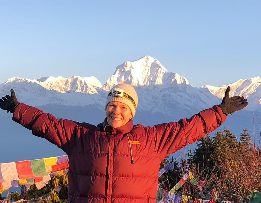
Your Upper Dolpo adventure begins upon arrival at Tribhuvan International Airport. A representative from Nepal Hiking Team will welcome you at the terminal and transfer you to your hotel in Kathmandu. After check-in, you will have time to relax and recover from your international flight.
Later in the day, we meet for a trek briefing where your guide explains the itinerary, equipment, and important details for the journey ahead. This is also the time to confirm permits and make final preparations before traveling to the remote Dolpo region.
Overnight stay at a hotel in Kathmandu.
Today we explore important cultural landmarks within the Kathmandu Valley with a professional guide. The tour includes visits to Pashupatinath Temple, one of the most sacred Hindu temples in Nepal, and Boudhanath Stupa, an important pilgrimage site for Tibetan Buddhism.
This sightseeing tour offers a cultural introduction to Nepal while giving you time to prepare for the remote trekking expedition ahead. After completing the tour, we return to the hotel for rest and final packing.
Overnight stay at a hotel in Kathmandu.
In the morning, we transfer to the domestic terminal for the flight to Nepalgunj, a warm lowland city near the Indian border. The flight offers views of Nepal’s changing landscapes as the terrain shifts from the Himalayan foothills to the flat plains of the western Terai.
Nepalgunj serves as the main transit hub for flights into the remote mountain regions of western Nepal. After arrival, we transfer to the hotel where you can relax and prepare for the early mountain flight scheduled the following morning.
Overnight stay at a hotel in Nepalgunj.
An early morning mountain flight takes us from Nepalgunj to Juphal Airport, the main gateway to the Dolpo region. After landing, we meet our trekking crew and begin the journey on foot. The trail descends gently toward Dunai, the administrative centre of Dolpa, before following the Phoksundo River upstream.
The route gradually enters the forests of Shey Phoksundo National Park, passing small settlements and cultivated terraces. Walking through pine and cedar forests along the valley, we eventually reach the village of Chhepka.
Overnight stay at a tented camp.
Leaving Chhepka, the trail follows the Phoksundo Khola upstream through dense forests of pine, birch, and bamboo. This section of the trek moves deeper into Shey Phoksundo National Park, offering chances to observe Himalayan wildlife and birdlife along the river valley.
The path climbs gradually along the gorge, small past settlements used by local villagers and traders. After several hours of steady walking, we reach Chunuwar, also known for the traditional Amchi hospital where Tibetan herbal medicine is practiced.
Overnight stay at a tented camp.
Today’s trek is shorter but very rewarding. The trail continues along the valley, then gradually climbs toward the stunning turquoise waters of Shey Phoksundo Lake.
As we approach the lake, the scenery opens dramatically with steep cliffs rising above the deep blue water. The traditional Bon village of Ringmo sits above the lake, offering impressive views across the surrounding mountains. The lake is located inside Shey Phoksundo National Park, Nepal’s largest national park.
Overnight stay at a tented camp near Ringmo village.
Today is reserved for rest and acclimatization near Shey Phoksundo Lake. Trekkers can explore Ringmo village and observe the traditional lifestyle of the local Dolpo people, who follow ancient Tibetan Buddhist and Bon traditions.
Optional hikes around the lake provide panoramic views of the turquoise water and surrounding cliffs. The day also allows time to visit nearby viewpoints and enjoy the peaceful landscape before continuing toward the higher passes of Upper Dolpo.
Overnight stay at a tented camp.
Leaving Shey Phoksundo Lake behind, the trail climbs along the western side of the lake on narrow paths carved into the rocky cliffs. This section offers spectacular views of the lake and surrounding mountains as the route enters a more remote alpine landscape.
After crossing several small streams and high ridges, the trail gradually descends into a quieter valley where we reach the campsite at Chunemba. This peaceful location marks the beginning of the more remote Upper Dolpo section of the trek.
Overnight stay at a tented camp.
Leaving Chunemba, the trail follows a remote valley that gradually climbs toward the high alpine terrain of Upper Dolpo. The landscape becomes increasingly barren as the route ascends above the tree line, revealing wide valleys and dramatic rocky ridges.
Walking along the river valley, the trail steadily gains elevation across open grazing lands used by local yak herders. As we approach the higher terrain, the scenery changes into rugged trans-Himalayan landscapes with distant snow-covered peaks. By late afternoon, we reach Snowfields Camp, a high-altitude campsite positioned below the Kang La Pass.
Overnight stay in a tented camp.
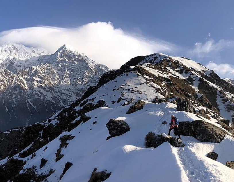
Today is one of the most significant days of the Upper Dolpo Trek as we cross the challenging Kang La Pass. The climb begins early in the morning as the trail ascends gradually across rocky slopes and high alpine terrain.
From the top of Kang La Pass, trekkers are rewarded with expansive views of the remote Dolpo landscape and surrounding Himalayan ranges. After crossing the pass, the trail descends toward the sacred valley of Shey before reaching Shey Gompa, one of the most important monasteries in the Dolpo region.
This historic monastery sits near Crystal Mountain, a revered pilgrimage site for local communities. The peaceful surroundings and ancient religious traditions make this one of the most memorable locations of the trek.
Overnight stay at a tented camp.
Today is reserved for rest and acclimatization at Shey Gompa. Trekkers have the opportunity to explore the monastery and learn about the spiritual traditions that have shaped life in this remote region for centuries.
Many trekkers also take short walks around the valley, including views toward the sacred Crystal Mountain, an important pilgrimage site where local devotees perform ritual circuits. The surrounding landscape features wide alpine valleys, ancient mani walls, and high Himalayan peaks.
This rest day allows time to recover from the previous day’s high pass crossing while preparing for the next stage of the Upper Dolpo journey.
Overnight stay at a tented camp.
Leaving Shey Gompa, the trail climbs gradually across high alpine terrain toward Shey La Pass. This section of the trek follows open mountain slopes with wide views of the surrounding Dolpo landscape. The ascent to the pass is steady but rewarding, offering impressive panoramas of the remote valleys and snow-capped peaks.
After crossing Shey La Pass, the trail descends toward the isolated village of Namgung. This traditional settlement . The peaceful setting and unique landscape make Namgung one of the most distinctive villages in Upper Dolpo.
Overnight stay at a tented camp.
Today’s trek is relatively short as the trail follows a high plateau across open fields and traditional farmlands. The route gradually descends along the valley while offering expansive views of the surrounding mountains and dry trans-Himalayan terrain.
After a few hours of walking, we arrive at Saldang, one of the largest villages in Upper Dolpo. The village lies along an ancient trading route connecting Tibet and Nepal and is known for its traditional Tibetan culture, stone houses, and agricultural terraces.
Overnight stay at a tented camp.
From Saldang, the trail continues eastward across the dry plateau landscapes of Upper Dolpo. The route follows the Nagon Khola valley, passing scattered settlements, mani walls, and grazing areas used by yak and sheep herders.
The trail gradually ascends along the valley before reaching the small settlement of Sibu. Located beside a stream and surrounded by rugged mountain slopes, Sibu serves as a quiet camping location before the higher passes ahead.
Overnight stay at a tented camp.
Leaving Sibu, the trail continues along the upper valley while gradually ascending toward higher alpine terrain. The landscape becomes increasingly rugged, with rocky slopes and wide open valleys characteristic of the trans-Himalayan region.
As we gain elevation, the route follows a quiet river valley used by local herders during the summer months. After several hours of steady walking, we reach Lagmo Che, a remote campsite situated beneath the high ridges leading toward Jeng La Pass.
Overnight stay at a tented camp.
Today, we cross another major high pass of the Upper Dolpo Trek, Jeng La. The climb begins early as the trail ascends gradually across rocky slopes toward the pass. From the summit of Jeng La, trekkers enjoy impressive views of the surrounding Himalayan peaks and the vast Dolpo landscape.
After crossing the pass, the trail descends into the upper Tarap Valley, eventually reaching Tokyu village. Tokyu is known for its traditional houses, ancient monasteries, and strong Tibetan cultural heritage. The village offers beautiful views across the wide Tarap Valley.
Overnight stay at a tented camp.
Today’s walk is relatively short as we travel through the wide and scenic Tarap Valley. The trail follows open grazing fields and traditional farmlands while gradually descending toward the village of Dho Tarap.
Dho Tarap is one of the most culturally rich villages in the Dolpo region. The settlement is known for its ancient monasteries, traditional stone houses, and a strong presence of both Buddhist and Bon traditions. The surrounding valley offers expansive views of the high mountains and alpine landscapes.
Overnight stay at a tented camp.
Leaving Dho Tarap, the trail follows the Tarap Khola downstream as the wide valley gradually narrows into a rugged canyon. The route descends through open meadows and grazing fields before entering a dramatic gorge surrounded by steep rock walls.
As we continue along the river, the landscape begins to change from high alpine plateau to deeper river valleys. After several hours of walking along the canyon trail, we reach Sisaul, a quiet campsite located beside the river.
Overnight stay at a tented camp.
Today’s trek follows the Tarap Khola through a spectacular canyon landscape. The trail frequently crosses small streams and narrow paths carved into the cliffs as it descends steadily through the valley.
This section of the route is known for its dramatic rock formations and deep river gorges. After a long but scenic trekking day, we reach Laina Odar, a natural cave-like shelter often used by trekkers and traders traveling through the region.
Overnight stay at a tented camp.
The trail continues greener. Forests begin to reappear along the route, and the river valley widens as we move toward the lower Dolpo region.
Walking through a mixture of forest trails and riverside paths, we eventually reach Lingdo, a small settlement surrounded by cultivated terraces and forested hillsides.
Overnight stay at a tented camp.
Leaving Lingdo, the trail continues along the Bheri River valley, gradually transitioning, from rugged canyon terrain to greener hillsides. The route follows well-defined paths through forests, cultivated fields, and small villages scattered across the valley.
As we approach Dunai, the administrative centre of the Dolpo region, the trail widens and the surrounding scenery opens into terraced farmland and traditional settlements. Dunai is the largest town in Dolpo and serves as an important trading and administrative hub for the region.
Overnight stay at a tented camp.
Today marks the final trekking day of the Upper Dolpo journey. The trail gradually climbs from Dunai toward Juphal Airport, following a well-established path through cultivated terraces and hillside villages.
The ascent offers final views of the surrounding valleys before reaching Juphal. Upon arrival, we celebrate the completion of the trekking journey and prepare for the return flight to Kathmandu the following day.
Overnight stay at a tented camp.
Early in the morning, we take a scenic mountain flight from Juphal to Nepalgunj. After a short transit stop, we continue the flight back to Kathmandu.
Upon arrival in Kathmandu, you will be transferred to your hotel, where you can relax and enjoy the comforts of the city after the remote Upper Dolpo expedition.
Overnight stay at a hotel in Kathmandu.
Today is reserved as a leisure day in Kathmandu. After completing the Upper Dolpo trek, this day allows time to relax, explore the city, or visit local markets and cultural sites at your own pace.
You may choose to revisit areas such as Boudhanath Stupa or explore the traditional markets of Thamel for souvenirs and handicrafts. In the evening, we gather for a farewell dinner to celebrate the successful completion of the expedition.
Overnight stay at a hotel in Kathmandu.
Your Upper Dolpo adventure concludes today. A representative of the Nepal Hiking Team will transfer you to Tribhuvan International Airport for your international departure.
We hope this remarkable journey through the remote valleys, high passes, and ancient villages of Dolpo leaves lasting memories of one of Nepal’s most extraordinary trekking regions.
Upper Dolpo is a restricted Himalayan region, so special permits are mandatory for all trekkers entering the area. The main permit required is the Restricted Area Permit (RAP), which costs USD 500 per person for the first 10 days and USD 50 for each additional day spent in the region. In addition, trekkers must obtain the Shey Phoksundo National Park Permit (USD 30) and the TIMS card (USD 20) issued by the Nepal Tourism Board.
Because Upper Dolpo is a restricted area, trekking independently is not allowed. Trekkers must travel with a registered trekking company and a licensed guide throughout the journey. Nepal Hiking Team arranges all permits and documentation in advance so that trekkers can begin the expedition smoothly upon arrival in Nepal.
The most favorable seasons for the Upper Dolpo Trek are spring (mid April to May) and autumn (September to October). During these months, the skies are usually clear, mountain visibility is excellent, and temperatures are stable for trekking at high altitude.
Upper Dolpo lies in the rain shadow of the Dhaulagiri Himal range, which means it receives far less rainfall than many other trekking regions in Nepal. Because of this, trekking during the summer monsoon months between June and August is also possible, although flights and logistics can sometimes be affected by weather conditions in other parts of the country.
Winter from December to February brings heavy snowfall and extremely cold temperatures, often closing the high passes and making travel very difficult.
The Upper Dolpo Trek is considered one of Nepal's most demanding trekking journeys. The route crosses multiple high mountain passes, remote valleys, and long stretches of wilderness where settlements are rare.
Daily trekking generally ranges between 4 and 8 hours, although some days involving pass crossings can require longer walking time depending on weather and trail conditions. Good cardiovascular fitness and stamina are essential for completing the trek comfortably.
Trekkers who regularly participate in hiking, running, cycling, or endurance activities tend to adapt well to the demands of the route. Previous trekking experience at moderate altitude is helpful, though careful pacing and proper acclimatization are more important than speed.
Upper Dolpo is a high altitude trekking region where large portions of the trail remain above 4,000 meters. The trek crosses several major Himalayan passes including Nagdalo La (5,350 m), Mola La (5,030 m), Niwar Pass (5,120 m), and Jungben La (5,550 m).
Because of these elevations, gradual altitude gain and rest days are important parts of the itinerary. Locations such as Phoksundo Lake and Shey Gompa provide ideal opportunities for acclimatization while also allowing trekkers to explore the region's cultural landmarks.
Our guides maintain a steady walking pace and monitor trekkers closely to ensure safe adaptation to the altitude throughout the journey.
Reaching Upper Dolpo requires travel through western Nepal. The journey begins with a flight from Kathmandu to Nepalgunj, followed by a mountain flight from Nepalgunj to Juphal, which is the starting point of the trek.
Flights to Juphal operate using small aircraft and are highly dependent on mountain weather conditions. Delays or schedule adjustments can occasionally occur, especially during early morning flights. For this reason, it is always recommended to keep extra buffer days in the travel plan.
Upper Dolpo remains one of the most remote trekking regions in Nepal with very limited lodge infrastructure. Because of this, the trek is conducted as a fully supported camping expedition.
Nepal Hiking Team arranges the full camping setup including sleeping tents, dining tents, kitchen equipment, and a professional support crew. The team ensures comfortable campsites each evening and manages all logistics required for the expedition.
Camping also allows trekkers to explore remote valleys and high passes that remain untouched by modern tourism infrastructure.
All meals during the trek are freshly prepared by an experienced expedition cook and kitchen team traveling with the group. The menu typically includes a variety of nutritious meals designed to provide sufficient energy for trekking at high altitude.
Meals usually include soups, rice, pasta, potatoes, vegetables, eggs, and occasionally local dishes inspired by Tibetan cuisine. Trekkers are also encouraged to bring personal snacks such as energy bars, nuts, or chocolate.
Safe drinking water is provided through boiled or purified water prepared by the expedition team.
Upper Dolpo is one of the most isolated regions in Nepal. Many villages remain accessible only by foot, and the area has very limited road or modern infrastructure. The remoteness is part of what makes the trek so special, as it offers an authentic Himalayan experience rarely found in other regions.
Trekkers should be prepared for long distances between settlements and a landscape where traditional lifestyles continue largely unchanged.
Communication options along the Upper Dolpo route are extremely limited. Mobile phone networks are rarely available once the trek begins, and reliable internet connections do not exist in most villages.
For safety, expedition teams may carry satellite communication devices or emergency communication equipment when traveling through remote sections of the route.
Trekkers should inform family and friends before departure that contact may not be possible for several days during the trek.
There are no ATMs or banking facilities anywhere along the Upper Dolpo trekking route. Trekkers should prepare all necessary cash before leaving Kathmandu.
Personal spending along the trail is minimal because the expedition is fully supported, but some travelers prefer to carry cash for small purchases in villages or for gratuities to the trekking crew at the end of the journey.
Upper Dolpo preserves a unique cultural identity shaped by centuries of Tibetan influence. The local communities follow Tibetan Buddhism as well as the ancient Bon religion, one of the oldest spiritual traditions in the Himalayan region.
Ancient monasteries, prayer walls, chortens, and traditional stone villages appear throughout the trek. Visitors are encouraged to respect local customs by walking clockwise around religious monuments and asking permission before taking photographs of people or inside monasteries.
One of the most important cultural sites along the trek is Shey Gompa, a centuries old monastery located beneath the sacred Crystal Mountain. Pilgrims from across the Himalayas visit this monastery during special religious festivals.
The monastery and surrounding valley are considered sacred landscapes in Tibetan Buddhist tradition and offer trekkers a rare opportunity to witness living Himalayan spirituality.
The turquoise waters of Shey Phoksundo Lake are among the most striking natural landmarks in Nepal. Located at an altitude of approximately 3,611 meters, the lake is famous for its deep blue color and dramatic cliffs that rise directly above the shoreline.
The lake is part of Shey Phoksundo National Park, Nepal's largest national park, and serves as a highlight for many trekkers traveling through the Dolpo region.
Upper Dolpo lies within a protected ecosystem where wildlife thrives in high altitude habitats. The region is known for rare Himalayan species including snow leopards, Himalayan blue sheep, musk deer, Himalayan tahr, griffon vultures, and the Himalayan monal.
The landscape itself changes dramatically along the route. Trekkers walk through dense forests, alpine meadows, river gorges, and high altitude desert plateaus that resemble the landscapes of Tibet.
The fragile ecosystems and traditional cultures of Upper Dolpo require responsible travel practices. Trekkers are encouraged to minimize waste, respect local customs, and follow the guidance of their trekking team throughout the journey.
Nepal Hiking Team follows responsible trekking standards, ensuring fair working conditions for porters, proper waste management during camping expeditions, and respectful interaction with local communities.
Preparing properly for the Upper Dolpo Trek helps ensure a safer and more enjoyable experience. Trekkers should focus on building endurance through hiking, walking, or cardio training before arriving in Nepal.
Because of the remote nature of the expedition, it is also important to bring suitable trekking equipment including warm clothing, durable hiking boots, and personal essentials required for high altitude trekking.
Proper preparation allows trekkers to focus on the remarkable landscapes, culture, and wilderness that make Upper Dolpo one of the most extraordinary trekking journeys in the Himalayas.
Read our genuine feedback from past travelers with Nepal Hiking Team sourced from TripAdvisor, Google, Facebook, and Trustpilot.
Experience of a lifetime! Leading up to the trip, I felt some excitement and uncertainty because I was traveling from New Jersey to Nepal, so it was a trip to the other side of the world. Also knowing we were going to trek to the highest region in the world.
Once we arrived in Kathmandu, we met up with our guide (Bhim). After a few minutes of talking with him, I felt a sense of calm and my excitement of joy grew from there. And I was right he and his team made sure we had the best experience possible.
The full trek going and coming was incredible. Our guide, Bhim, made sure we had the best experience. Can’t say enough of how wonderful he and his team made this one for the books!
I highly recommend booking with this company and Bhim! Namaste!
I just completed trekking in Nepal together with another solo traveler. The service of Nepal Hiking Team was exemplary from the start till the end. Nothing beats word-of-mouth good reviews.
Mr. Ganga has been very responsive to queries from Day 1 and was physically present even on the last day to officially close the loop for the package tour.
Our guide Bibek was very patient and sincere as he led us through the trek. He resolved issues with his heart and people skills and gave assurance whenever plans suddenly changed.
He ensured things were changed for the better. Our porter, Rajendran, was also good and always arrived ahead of time to ensure our rooms were confirmed.
- Guided by Bibek Dhamala
We had the best time in Nepal. The beautiful views and warm hospitality of the Nepali people are truly unparalleled.
Instrumental to our amazing experience were our guide, Netra, and porter, Vasu.
We were super well taken care of. Netra was quick to assess our physical abilities and was able to effectively set the pace for our hikes. He had very good knowledge of the route and terrain. Importantly, this was our first time attempting a hike at a high altitude, so he took extra care to check on us regularly.
On a personal note, proper gear, including a powerful down jacket for -20 degrees Celsius and a proper hiking backpack, is super essential.
Overall, I would highly recommend the Nepal Hiking Team and Netra/Vasu for your Nepal adventure!
We were a group of 17 people from California who had been preparing for a year for this trip. Nepal Hiking Team was referred to us by one of my friends. After talking to & interviewing several companies, NHT seemed very responsive, cost-effective & experienced. After the trip, they proved us nothing less.
Their guides are top-of-the-line, very kind, and helpful. They made sure we all were prepared for the next day, set our expectations rights, & guided us through managing altitude sickness.
We all made it to Nepal and came back happy and healthy.
We all thank NHT for making our dream come true, and looking forward to many more with them.
I highly recommend the Nepal Hiking Team for anyone planning to trek in Nepal. My spouse and I had a fantastic time on our trek and greatly credit our positive experience to the thought and care put into it by Nepal Hiking Team in coming up with a personalized plan that would enable us to succeed.
Every detail was considered to match us based on our abilities and interests. We also could not have felt more cared for minute to minute by the team that supported us from the minute we arrived in Kathmandu until our departure.
Our guide, Nim, was amazing -- so careful, thoughtful, warm, and supportive. And our porters, Sabin and Ganesh, were delightful. They were all unbelievably generous in terms of how much they worked to ensure we were comfortable and prepared. They thought of every detail along the way.
- Guided By Nim Dahal
Nepal Hiking Team has over a decade of experience organizing treks in Nepal's most remote and restricted regions, including Upper Dolpo. We hold Tourism License No. 1033 and are registered members of TAAN (Trekking Agencies Association of Nepal) and NMA (Nepal Mountaineering Association). Our expert guides are intimately familiar with the Dolpo region's challenging terrain, altitude, and special permit requirements. We handle all logistics — from restricted area permits to tented camp setups — so you can focus entirely on the experience. Our 5-star reviews from hundreds of travelers reflect our commitment to safety, quality, and personalized service.
The Upper Dolpo Trek requires a minimum group size of 4 passengers for a guaranteed departure. If you are booking as a smaller group or solo traveler, we can combine your booking with other travelers to meet the minimum. Once the minimum is confirmed, your departure is guaranteed regardless of whether additional travelers join. Please contact us to check available departure dates and current group availability.
Yes, solo travelers are welcome to join group departures for the Upper Dolpo Trek. We regularly match solo travelers with others heading to Dolpo. Since the trek requires a minimum of 4 people, solo bookings are confirmed once that threshold is met. As a solo traveler, you'll benefit from shared costs on permits, guides, porters, and tented camp equipment — making it significantly more affordable than a fully private trip.
Absolutely. Nepal Hiking Team offers fully private departures for the Upper Dolpo Trek for individuals, couples, families, or friend groups. A private trip gives you full control over your start date, pace, and any customizations to the itinerary. Private trips are available year-round subject to permit availability and seasonal access. Contact us to get a personalized quote for your group size and preferred travel dates.
Yes, most nationalities can obtain a Tourist Visa on arrival at Tribhuvan International Airport (TIA) in Kathmandu. The visa fee is USD 30 for 15 days, USD 50 for 30 days, and USD 125 for 90 days. You will need a valid passport with at least 6 months remaining validity, a passport-sized photo, and USD cash or a credit card for payment. Indian nationals do not require a visa. We recommend checking Nepal's latest visa policy before travel as requirements may change.
Yes, all airport transfers are included in the Upper Dolpo Trek package. A Nepal Hiking Team representative will meet you at Tribhuvan International Airport upon arrival and transfer you to your hotel in Kathmandu in a private vehicle. Similarly, we will arrange your transfer to the airport on your departure day. We also handle all inter-city and domestic airport transfers during the trek, including Kathmandu–Nepalgunj and Nepalgunj–Juphal flights.
The Upper Dolpo Trek package includes four nights at a 3-star category hotel in Kathmandu with breakfast. Our standard partner hotels are well-located, clean, and comfortable. If you would like to upgrade to a 4-star or 5-star hotel, we can arrange that for an additional cost. Please let us know your preferences when booking and we will provide upgrade options and pricing.
Extra nights in Kathmandu at our standard 3-star partner hotels typically cost between USD 40–70 per night including breakfast. Upgraded 4-star hotels range from USD 80–120 per night, and 5-star options start from USD 150+ per night. Rates may vary by season and availability. Contact us in advance if you plan to extend your stay so we can arrange accommodation at the best available rate.
Before departing for the trek, you will attend a pre-trek briefing with your assigned guide at our Kathmandu office. During this session, you will receive a full overview of the 25-day itinerary, daily hiking distances, altitude profiles, and key highlights. The guide will also review your permits, emergency protocols, altitude sickness prevention, equipment checklists, and what to expect in the restricted Inner Dolpo region. This is also the best time to ask questions, discuss any health concerns, and make final gear adjustments.
You can book the Upper Dolpo Trek by contacting us via our website, email (sales@nepalhikingteam.com), or WhatsApp (+977 9851 058678). A deposit of 20–30% of the total trek cost is required to confirm your booking and begin the permit application process. Given the restricted area permits and logistical complexity of the Upper Dolpo Trek, we strongly recommend booking at least 2–3 months in advance, especially for peak season (May and September) departures.
The remaining balance can be paid upon your arrival in Kathmandu, before the trek begins. We accept payment via bank transfer, credit/debit cards (Visa, MasterCard, Amex, Discover, JCB, UnionPay, Diners Club), or cash in USD, EUR, or GBP. Detailed payment instructions are available on our website at nepalhikingteam.com/how-to-make-payment.
Our cancellation policy follows Nepal's trekking industry standards. Cancellations made well in advance (typically 30+ days before departure) may be eligible for a partial refund or credit toward a future trek. Cancellations closer to the departure date may result in forfeiture of the deposit, particularly if permits have already been purchased. We recommend reviewing our full Terms and Conditions at nepalhikingteam.com/terms-and-conditions and purchasing comprehensive travel insurance that covers trip cancellation.
The Upper Dolpo Trek involves multiple modes of transport. From Kathmandu, you fly to Nepalgunj (approx. 1 hour) by domestic aircraft. The following morning, you take a short 35-minute flight from Nepalgunj to Juphal airport — a dramatic mountain airstrip in Dolpa. All flights are included in the package. After completing the trek, you fly back from Juphal to Nepalgunj and then onward to Kathmandu. All ground transfers in Kathmandu are by private vehicle.
Yes. Juphal (Dolpa) airport is a remote mountain airstrip highly susceptible to weather delays and cancellations. Flight operations depend on visibility and wind conditions. Delays of 1–3 days are not uncommon, especially during early spring and late monsoon shoulder periods. We strongly advise building buffer days at the end of your trip and purchasing travel insurance that covers flight delays and additional accommodation costs due to weather disruptions.
Nepalgunj is a bustling lowland city in southwestern Nepal near the Indian border, quite different in character from Kathmandu or the mountains. The package includes one night's accommodation in Nepalgunj with breakfast. While there, you can explore the lively bazaar, visit the Bageshwori Temple, or simply rest before your early morning flight to Juphal. Nepalgunj is typically warm and humid compared to the cool mountain air you'll encounter in Dolpo.
The Upper Dolpo Trek is graded as Strenuous — one of the most challenging treks available in Nepal. The route crosses four high mountain passes, including Kang La (5,375m) and Jeng La (5,110m), with daily hikes ranging from 3–8 hours over rugged, remote terrain. There are no teahouses en route; all accommodation is in tented camps. The extreme remoteness means evacuation in an emergency is very difficult. This trek is best suited for experienced trekkers with prior high-altitude experience above 4,000m.
The full Upper Dolpo Trek is 25 days. This includes 2 nights in Kathmandu, 1 night in Nepalgunj, approximately 19 days of active trekking and acclimatization in the Dolpo region, and 2 days for return flights and leisure in Kathmandu. The core trekking section spans from Juphal to Phoksundo Lake, through the Inner Dolpo restricted zone, over multiple high passes, through the Tarap Valley, and back to Juphal.
There is no strict upper or lower age limit for the Upper Dolpo Trek, but given its strenuous classification, we recommend it for participants aged 18–65 who are in excellent physical health. Participants over 60 or with pre-existing health conditions are advised to consult their physician before booking and may be required to submit a medical fitness certificate. Children and teenagers may join at parental discretion, though the remoteness and physical demands of this trek make it unsuitable for very young trekkers.
For such a strenuous trek, physical preparation should begin 3–6 months in advance. Recommended training includes: daily cardio (running, cycling, swimming) to build cardiovascular endurance; long-distance hiking with a loaded backpack (10–12kg) to simulate trekking conditions; leg-strengthening exercises like squats, lunges, and stair climbing; and if possible, practice hikes at altitude above 3,000m. Core strength training also helps with balance on rocky and uneven terrain. The fitter you are before you arrive, the safer and more enjoyable your experience in Dolpo will be.
Yes — travel insurance is mandatory for the Upper Dolpo Trek and is listed as a cost exclusion that you must arrange independently. Your policy must cover high-altitude trekking up to at least 5,500m, emergency helicopter evacuation (Dolpo is extremely remote and evacuation requires a helicopter), trip cancellation (including weather-related flight delays), and medical evacuation to Kathmandu or your home country. We strongly recommend purchasing insurance from a reputable provider before departing your home country.
Nepal Hiking Team's highly experienced guides are trained in Wilderness First Aid and altitude sickness management. They carry a comprehensive first aid kit on every trek. Guides closely monitor each trekker for signs of altitude sickness (AMS), particularly around the high passes. If a trekker shows serious symptoms, the guide is authorized to make immediate decisions, including descent or helicopter evacuation. Emergency contact numbers and helicopter evacuation protocols are reviewed during the Kathmandu briefing. Guides also plan itineraries with built-in acclimatization days at Phoksundo Lake and Shey Gompa.
The best time for the Upper Dolpo Trek is May to September. Unlike most Nepal treks, Upper Dolpo lies in the rain shadow of the Himalayas, meaning the monsoon (June–August) does not significantly affect the region. May and September/early October are the most popular months with the most stable weather and best mountain views. The area is generally inaccessible from November through April due to heavy snowfall on the high passes.
Yes — Upper Dolpo is one of Nepal's few treks that remains accessible and pleasant during the summer monsoon (June–August). The region sits behind the Himalayan rain shadow, so while southern Nepal receives heavy rainfall, Dolpo remains relatively dry with clear skies and dramatic landscapes. Summer is actually a viable and uncrowded window for this trek. However, the approach flights to Nepalgunj and Juphal can sometimes be disrupted by weather in the Terai lowlands.
While no vaccines are legally required for entry into Nepal, several are strongly recommended before undertaking a remote trek in Upper Dolpo. These typically include Hepatitis A and B, Typhoid, Tetanus-Diphtheria, Rabies (given the remoteness from medical care), Japanese Encephalitis (if traveling via Terai lowlands), and ensuring your routine vaccinations (MMR, flu) are up to date. We strongly advise consulting a travel medicine specialist or your GP at least 6–8 weeks before departure.
Altitude sickness is a real concern on the Upper Dolpo Trek, with camps and passes reaching above 5,000m. Key prevention strategies include: ascend gradually and follow the itinerary without rushing; stay well hydrated (3–4 liters of water per day); avoid alcohol and sleeping pills at altitude; rest adequately at acclimatization days (Phoksundo Lake at 3,733m and Shey Gompa at 4,310m); discuss with your doctor whether prophylactic Diamox (Acetazolamide) is appropriate for you; and most importantly, communicate any symptoms to your guide immediately. Early recognition and prompt descent are the most effective treatments for serious AMS.
The Upper Dolpo Trek does include some exposed trails, narrow cliff-side paths, and high mountain passes with steep descents. Notably, the 'Demons Trail' section along Phoksundo Lake involves a narrow, vertiginous path high above the water. If you have a fear of heights or exposed ridges, this is something to discuss with our team before booking. Our guides are experienced in supporting trekkers through challenging sections, but given the remoteness and strenuous nature of this trek, it is important to honestly assess your comfort with exposure.
Yes, porters are included in the Upper Dolpo Trek package. Each porter typically carries 20–25kg of shared trekking equipment (tents, kitchen gear, group supplies) in addition to trekkers' personal duffel bags. As a rule of thumb, your personal duffel bag should not exceed 10–12kg. You carry a day pack (3–5kg) with water, snacks, layers, and personal items during daily hikes. Nepal Hiking Team provides each trekker with a duffel bag for the trek.
Given the high altitude (passes above 5,000m), remote wilderness camping, and variable weather, essential gear includes: a high-quality sleeping bag rated to at least -15°C, sturdy trekking boots broken in before the trip, trekking poles (highly recommended for steep passes), moisture-wicking base layers, insulating mid-layers (down jacket provided by NHT), waterproof outer shell, warm hat and gloves, sun protection (sunscreen SPF 50+, sunglasses, lip balm), water purification tablets or filter, and a personal first aid kit. Nepal Hiking Team provides a down jacket, sleeping bag, and duffel bag on loan during the trek.
Yes. You can store your extra luggage (non-trekking bags, valuables, city clothes) at your hotel in Kathmandu at no charge or for a minimal fee. This is standard practice — trekkers travel to Dolpo with only their duffel bag and day pack, leaving behind anything not needed on the trail. We coordinate with our partner hotels to ensure your stored luggage is safe and ready upon your return to Kathmandu.
Yes. Nepal Hiking Team provides a down jacket, sleeping bag, and a duffel bag on loan for the duration of the trek — all of which are essential for Upper Dolpo's cold nights and high-altitude camps. These items must be returned at the end of the trek. All tented camp equipment (two-person tents, dining tent, kitchen tent, tables, chairs, and kitchen utensils) is also provided by the team and carried by porters throughout the trek.
Yes! Nepal Hiking Team provides a trekking completion certificate upon successfully finishing the Upper Dolpo Trek. This is a meaningful memento of what is one of the most challenging and remote treks in the world. You will also receive an Upper Dolpo trekking map and an NHT T-shirt as part of your package.
Unlike standard Nepal treks that use teahouses, the Upper Dolpo Trek is a fully tented camping trek. Nepal Hiking Team provides all camping equipment: two-person sleeping tents, a dining tent, and a kitchen tent. Mattresses are provided inside the sleeping tents. There are no teahouses or guesthouses along the remote Inner Dolpo route. In Kathmandu, you stay in a comfortable 3-star hotel, and in Nepalgunj, accommodation is included for one night.
Mobile and internet connectivity is extremely limited on the Upper Dolpo Trek. The region is one of the most remote in the world, and there is essentially no reliable mobile signal or Wi-Fi once you are beyond Juphal and inside the National Park and restricted zone. In Nepalgunj and Kathmandu, you will have full connectivity. We recommend purchasing a local SIM card (Ncell or Nepal Telecom) for use in Kathmandu and Nepalgunj. Family and friends should be briefed that you will be unreachable for most of the 25-day trek.
There are no electrical outlets available once you enter the trekking route beyond Juphal. We strongly recommend bringing a high-capacity portable power bank (20,000–30,000mAh) to charge your phone, camera, and GPS devices throughout the trek. Solar charging panels are also a practical option. In Kathmandu and Nepalgunj hotels, standard 220V Nepal outlets are available for pre-trek charging.
No. The Upper Dolpo Trek is a remote wilderness trek with no permanent teahouse infrastructure. Toilet facilities along the route are basic pit latrines where they exist, or open-air facilities in nature otherwise. Nepal Hiking Team's camping setup includes a toilet tent for privacy. We encourage Leave No Trace practices throughout the trek to protect the pristine Dolpo environment.
The standard package includes twin-sharing tented accommodation (two trekkers per sleeping tent). If you prefer a single occupancy tent, this can be arranged for a supplement fee. Please request a single tent at the time of booking so we can plan the camp setup accordingly. Contact us for current single supplement pricing based on your group size and departure date.
All meals during the trek are prepared by our experienced cook on a full-board basis (breakfast, lunch, dinner, tea, and coffee). Meals are freshly cooked in the kitchen tent each day. The menu typically includes a mix of Nepali and international dishes such as dal bhat (lentil soup with rice), pasta, noodles, soups, chapati, porridge, eggs, potatoes, and seasonal vegetables. While the selection is naturally more limited than in Kathmandu, our cook works hard to provide nutritious, hot, and satisfying meals throughout the 19+ days in the field.
Vegetarian and vegan diets can be accommodated on the Upper Dolpo Trek — please inform us at the time of booking. The standard Nepali trekking diet is naturally plant-heavy (dal bhat, vegetables, pulses, rice), making vegetarian options relatively straightforward. Gluten-free requirements are more challenging in a remote wilderness camping context due to limited ingredient availability in Dolpo. Please discuss specific dietary requirements with us in advance so our cook can prepare accordingly and carry appropriate supplies.
Safe, boiled drinking water is provided by our team throughout the Upper Dolpo Trek. Our cook boils and treats water daily from mountain streams and rivers along the route. You should always use the boiled water provided rather than drinking untreated water directly from streams, even if it appears clear. We recommend also carrying water purification tablets or a personal water filter as a backup. Purchasing bottled mineral water in this remote region is not possible, so relying on your team's boiled water supply is essential.
The Upper Dolpo Trek requires several permits, all of which are included in the package price and arranged by Nepal Hiking Team on your behalf. These include: the Restricted Area Permit (RAP) for Inner Dolpo — one of the most expensive trekking permits in Nepal at USD 500 per person for the first 10 days and USD 50 per day thereafter; the Shey Phoksundo National Park entrance fee; and TIMS (Trekking Information Management System) card. Given the cost and limited daily quota of Inner Dolpo permits, early booking is essential.
Upper Dolpo (Inner Dolpo) is classified as a Restricted Area by the Government of Nepal, meaning independent trekking is not permitted. All trekkers must be part of a registered group with a licensed Nepali trekking agency and a licensed guide. The restricted status aims to preserve the fragile trans-Himalayan ecosystem, the unique Tibetan-origin culture, and the traditional Bon Po religion still practiced in villages like Ringmo. This also means daily visitor numbers are limited, keeping Upper Dolpo one of the most pristine and uncrowded trekking destinations in the world.
No. Independent trekking is strictly prohibited in the Upper Dolpo restricted area. By law, all trekkers must be accompanied by a licensed Nepali trekking guide and booked through a registered agency. Nepal Hiking Team handles all permits, guide assignments, and logistical arrangements on your behalf. Attempting to enter the restricted zone without the correct permits and a licensed guide can result in fines, deportation, or serious legal consequences.
Yes. Nepal Hiking Team offers fully customizable Upper Dolpo Trek itineraries for private groups. You can adjust the departure date, extend or shorten certain sections, add side trips to additional monasteries or viewpoints, modify the pace to allow for photography or cultural immersion, or combine Upper Dolpo with Lower Dolpo or other regions. Simply contact us with your interests and travel dates and we will design a personalized itinerary. Note that the restricted area permit dictates a minimum duration within Inner Dolpo.
Yes. A Kathmandu valley sightseeing day is included in the Upper Dolpo Trek package. On Day 2, a licensed local tour guide will take you to Kathmandu's UNESCO World Heritage Sites, including Kathmandu Durbar Square, Swayambhunath Temple (Monkey Temple), Boudhanath Stupa, and Pashupatinath Temple. All entry fees and private vehicle transportation for this tour are included. Additional city tours or day trips (e.g., Bhaktapur, Patan, Nagarkot) can be arranged at extra cost on your free day.
Tipping is not included in the package price but is a deeply appreciated and culturally important gesture for your trekking crew. The standard practice is to tip at the end of the trek, on the final day before returning to Kathmandu or on your last evening at camp. We recommend pooling tips from the whole group and presenting them collectively to the head guide, who will distribute appropriately among the crew.
Since Upper Dolpo is a fully inclusive tented camping trek with no teahouses to buy extras from, your personal spending needs are minimal on the trail itself. Budget approximately USD 300–500 for personal expenses covering: tipping for guides and porters (USD 10–15 per day for the guide; USD 5–8 per day per porter is customary), personal shopping in Kathmandu, optional cold drinks or alcoholic beverages, extra meals or activities not covered by the package, and any personal gear purchases in Thamel before departure. Bring USD cash as ATM access is unavailable in Dolpo.